The importance of early warning systems in disaster risk reduction

It is not enough for an early warning system to correctly identify an incoming hazard, it must also ensure that the populations and sectors that are at risk can receive the alert, understand it, and most importantly, act on it.

Disasters, increasingly frequent and intense, have become a major issue requiring urgent action. In 2021, 432 catastrophic events took place, incrementing the average of 357 annual catastrophic events recorded in 2001-2020. Only last year, 101.8 million people were affected worldwide, and the economic losses amounted to 252.1 billion US dollars.

The impacts of a disaster are often unequally distributed, affecting disproportionately the most vulnerable. These events cause a disruption in the economy and livelihoods of people, producing dramatic socio-economic downturns that hamper short-term recovery and long-term development. On this basis, the promotion of resilience to face all kinds of shocks and stresses is considered a key element for the global development agenda.

In line with this perspective, and in accordance with its mandate, the International Labour Organisation (ILO) has focused on building resilience through the promotion of employment and decent work.

In order to achieve this, the ILO works with its tripartite constituents – governments and employers’ and workers’ organizations – to develop a response to disasters that can answer immediate needs, but also deploy a long-term vision to build resilience for risk management through employment-centred measures. These include skills development, job creation through employment-intensive investments, enterprise support and business continuity management, among others.

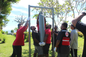
This year, the International Day for Disaster Risk Reduction focuses on early warning systems, a fundamental element to decrease the destructive impacts of a disaster. An effective early warning is capable of saving many lives and reducing damage by 30% if activated 24 hours before the event. However, today, one-third of the world’s population, mainly in the least developed countries, is still not covered by early warning systems.

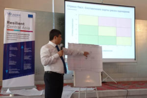
The purpose of early warning systems is mitigating the risk produced by disasters, but these risks are compounded by the socio-economic vulnerability of the population exposed to the hazards. In this context, early warning systems must be inclusive and sensitive to the different sources of vulnerability. As indicated by the United Nations Office for Disaster Risk Reduction (UNDRR) , these systems must be people-centred, end-to-end, and multi-hazard.

Early warning systems play a significant role in the world of work. By disseminating timely and accurate information regarding disaster risk, they enable preparedness action as well as a rapid response from workers, employers, and national or local authorities, and can therefore prevent human and economic losses in the workplace. For instance, farmers, pastoralists, fishers, and foresters are among the most-at-risk communities to disasters. Moreover, early warning systems can also play a crucial role in decent work, as part of the occupational health and safety standards in disaster-prone countries.

Early warning systems are essential to prepare and respond effectively in the short term, corresponding to the first stages of disaster management. Moreover, the implementation of such systems can also contribute to building resilience, as enhancing preparedness strengthens the capacity to recover rapidly, and reduces vulnerability.

Forest fires: €170 million to reinforce rescEU fleet

Following a record-breaking forest fire season in Europe, the Commission is proposing today €170 million from the EU budget to reinforce its rescEU ground and aerial assets  starting from the summer of 2023. The rescEU transitional fleet would therefore have a total of 22 planes, 4 helicopters as well as more pre-positioned ground teams. As from 2025, the fleet would be further reinforced through an accelerated procurement of airplanes and helicopters.

Commissioner for Crisis Management Janez Lenarčič said: "Due to climate change the number of regions affected by wildfires is increasing, going beyond the traditionally affected Mediterranean countries. The last summers have clearly shown that more firefighting assets are needed at EU-level. By building up our fleet of aerial means and ground forces, the EU will be able to ensure a prompt, flexible response, including in situations where fires are burning in multiple Member States at the same time.”

Commissioner for Budget and Administration, Johannes Hahn said: “While the record-breaking forest fires this summer may have been overshadowed by other crises, today's proposal to reinforce rescEU shows that the EU budget will continue to support those in need. European solidarity across EU Member States remains strong and we are ready to support this solidarity with financial means.”

Wildfires in the EU are increasing in scope, frequency, and intensity. By 1 October, the data for 2022 reveal a 30% increase in the burnt area over the previous worst year recorded (2017) and a more than 170% increase over the average burnt area since EU-level recording started in 2006.

This season, the Emergency Response Coordination Centre  received 11 requests for assistance for forest fires. 33 planes and 8 helicopters were deployed across Europe via the EU Civil Protection Mechanism, which were joined by over 350 firefighters on the ground. In addition, the EU's emergency Copernicus satellite provided damage assessment maps of the affected areas.

Makati City becomes the second Resilience Hub in Asia-Pacific

The City of Makati in the Philippines is named as the second Resilience Hub of Making Cities Resilient 2030 (MCR2030) in the Asia-Pacific region on 27 September 2022.

Makati has already been recognized as a Role Model City of the MCR 2010-2020 initiative by sharing know-how and experiences for reducing disaster risk, building urban resilience with other cities and participating in regional forums.

Under the leadership of Mayor Mar-len Abigail S. Binay, the city has adopted the principle of “Resilience is everybody’s business” at all sectors of society to manage disasters and build urban resilience in the country.

“We’re committed to continuing the journey of advocating resilience as a way of life through a Resilience Hub by collaborating with our constituents, partners and other local government units,” said Ms. Binay.

The Chief of the Regional Office for Asia and the Pacific at the United Nations Office for Disaster Risk Reduction (UNDRR), Mr. Marco Toscano-Rivalta, congratulated the Mayor, the City of Makati and its people for their vision and determination to continue strengthening disaster resilience and supporting other cities along the resilience pathway.

“Disaster risk is local, and it is at the local level where leadership, partnerships and solutions make a difference. MCR2030 is a catalyst for local action, a platform for collaboration and sharing of knowledge to localize disaster risk management and the implementation of the Sendai Framework for Disaster Risk Reduction,” said Mr. Toscano-Rivalta.

Makati, also known as a financial hub of the country, has developed a three-year plan of the Resilience Hub, which focuses on creating and building an online knowledge portal. The portal’s objective is to enhance peer-to-peer support, and disseminate risk data, information and expertise by conducting workshops, seminars and events related to strengthening urban resilience towards disaster risk reduction.

The plan also aims to improve city-to-city cooperation by working with other local governments in the Asia Pacific Region and beyond, promote synergies between cities to learn from each other and other disaster risk reduction activities, including capacity building, disaster preparedness, response and prevention.

The city is also in the process of developing the Makati Disaster Risk Reduction and Management Academy to learn from its best practices, using case studies and knowledge bases from other cities, leveraging experiences from an international group of practitioners who already participated in the initiative.

Notably, the city has continually mainstreamed and institutionalized disaster risk reduction management across all levels of the city since signing up to the MCR campaign in 2010.

As one of the pilot cities applying MCR tools, Makati held multi-sectoral annual workshops, reviewed and reassessed the city’s progress in implementing the Ten Essentials for MCR2030 through the Local Government Self-Assessment Tool.

The city was one of the first municipalities to utilize the Disaster Resilience Scorecard for Cities, which was developed through then UNISDR’s collaboration with global technology companies such as IBM and AECOM.

In 2017, the city established a resilience roadmap called the Makati Disaster Risk Reduction and Management Plan, using the now adapted Disaster Resilience Scorecard. Makati used Disaster Resilience Scorecard for Cities - Public Health System Resilience Addendum to enhance the city’s disaster risk reduction management.

A Resilient World? Understanding vulnerability in a changing climate

A recent report is the second report about the 2021 World Risk Poll findings and it shows how financial insecurity undermines resilience in the face of climate change-related disasters. Communities across the world are feeling the impact of natural and human-made hazards, whether that’s severe weather and its link with climate change, or the result of industrial, social, or environmental impacts. Revealing how people worldwide feel their country’s infrastructure and government can cope in the face of disasters, the report provides global insights into how prepared and resilient individuals believe their communities, countries, and institutions are in dealing with hazards. The findings can be used by governments, development agencies, businesses, and researchers to help them identify vulnerabilities and take action to make people safer.

Key findings of the report include:

- Over a third (34%) of people across the world said they could only cover their basic needs for less than a month if they lost all their income.
- People from lower income countries also have less confidence in their ability to protect themselves from a disaster.
- Results from the World Risk Poll global Resilience Index reveals which countries are most resilient to climate change-related and other disasters.
- 125,000 people in 121 countries were polled as part of the study.

Building resilience in Palau through early warning systems

The residents of Palau have benefitted from effective and low-cost, low-tech early warning systems, installed through the World Meteorological Organisation (WMO) Climate Risk and Early Warning Systems (CREWS) Pilot Project.

Palau initially received sirens which were installed as part of their early warning systems. However, the residents soon realised that these technologies also came with a myriad of challenges, including the sirens breaking down, difficulties in finding back ups or replacement parts, and the cost of maintenance.

These challenges were especially hard on the outlying islands, which did not have regular access to the necessary tools and resources needed to support and maintain the warning sirens.

The CREWS Pacific SIDS Pilot Project introduced the use of low-cost, low-tech early warning systems as a solution. These consisted mainly of bells that were strategically placed around the three initial areas of Ngaraard, Ngiwal and Kayangel.

The Palau National Weather Service took the lead in the implementation of the pilot project, in partnership with the National Emergency Management Office and the Palau Red Cross Society, which was already well established in the community through their Red Cross Disaster Action teams scattered throughout all 16 states of Palau.

Executive Director of the Palau Red Cross Society, Ms Maireng Sengebau, said they had to work with the community and build their capacity to understand what early warning systems are.

“We had to get them to accept these systems and show their support by providing us with a piece of land on which the bells would be installed,” she said.

Once the bells were installed, the Palau Meteorological Service, working in partnership with the Palau Red Cross Society, would meet with various communities and conduct table-top exercises and drills to familiarise them with the early warning systems and to demonstrate how and when they should be used.

"These activities empowered the people in communities. As a result of these meetings, they are now aware of what early warning systems are and why they are important, and also what to do when there is a disaster coming. They have now taken ownership the system and are the ones who operate it and they report to the state government if it needs maintenance.”

These simple early warning systems have contributed greatly to the resilience of the people of Palau.

“I joined the Palau Red Cross in 2017, and growing up, if there was a typhoon we would just buckle down in our houses and pray. Once the typhoon passes, we would wake up the next morning and just wait for government officials to come and bring help,” said Ms Sengebau.

“That is no longer the case. Now, before the typhoon even hits, families know when and how to act. If your house is not strong enough, they need to move to the evacuation shelter. If your house is strong, make sure that your family has a disaster kit.

“There are now things they can do to minimise the damage. Instead of waiting, we can now take action even before a disaster occurs. This is made possible through these early warning systems, and how they have empowered people in communities to act during natural disasters.”

Police Committee Initiates Process to Consider the Critical Infrastructure Protection Act Regulations

The Portfolio Committee on Police in South Africa has resolved to allow the Civilian Secretariat for Police Service (CSPS) to table part of the regulations of the Critical Infrastructure Protection Act (CIPA) 2019, which deals directly with the functions of the Critical Infrastructure Council to enable the council to start performing its functions immediately. The committee today met the Ministry of Police and representatives of the CSPS.

The committee has urged the CSPS to move with speed to table the regulations to ensure that Parliament completes the process of considering them. “We have raised a concern that the committee undertook an extensive process of interviews for the council in 2021 and to date, the Council has not been able to move and implement their mandate. This is the reason we will move with speed to consider the regulations and ensure the effectiveness of the Council,” said Ms Tina Joemat-Pettersson, the Chairperson of the committee.

Meanwhile, the committee deliberated on various issues affecting policing, including crime statistics, morale within the South African Police Service (SAPS), the increase in illegal mining, and challenges with gender-based violence. As a result, the committee agreed on the need for a two-day session, where the Minister of Police together with the National Commissioner and senior leadership of the SAPS outline strategies to remedy these concerns. The session’s intentions are to work together to find solutions to the crime challenge facing the country in order to create a safe environment that fosters socio-economic development.

IOM supports Palau to build community resilience and preparedness to natural hazards

The Republic of Palau is exposed to natural hazards such as storm surges, typhoons, earthquakes, and tsunamis that can result in localized and national emergencies as well as population displacement.

The International Organization for Migration (IOM), in partnership with the National Emergency Management Office (NEMO), has been working closely with the Government of the Republic of Palau (Palau) and community members to prepare for, and respond in a timely manner to, lifesaving needs during natural hazards and shocks.

IOM, under the Palau Emergency Preparedness and Enhanced Resilience project, funded by the United States Agency for International Development’s Bureau of Humanitarian Assistance, engaged the Government of the Republic of Palau, NEMO, Palau Red Cross Society, Ministry of Education, and community members in tabletop exercises to test emergency response plans and procedures and address operational gaps by working closely with relevant authorities.

"Employing a comprehensive approach to disaster risk management requires the contribution and engagement of various government actors as well as community group representatives at all stages of the preparedness, response and recovery process," says Salvatore Sortino, Chief of Mission to IOM Federated States of Micronesia, Republic of the Marshall Islands, and Republic of Palau.

"Tabletop exercises like these are key to ensuring comprehensive understanding and full ownership of respective roles and responsibilities. We are extremely grateful to NEMO for their leadership in these exercises," Sortino added.

IOM together with key government and non-government representatives reviewed Early Warning Processes to improve early warning systems, underlining roles and responsibilities of stakeholders in the event of a natural hazard.

In Melekeok State, where tsunami preparedness systems need strengthening, IOM conducted a tabletop exercise to simulate hazard events and enable coordination on effective use of emergency communication channels, emergency evacuation routes, and school evacuation procedures among other critical aspects of tsunami response.

These tabletop exercises complement ongoing efforts to address critical needs by improving evacuation shelters and their management to minimize injury and loss of life, as well as testing government response structures and pre-positioning relief items.

IOM revamped five emergency evacuation shelters (EES) including the installation of typhoon shutters, and provision of water tanks, generators, and solar lights.

Additionally, through the project, more than 80 community representatives in five states have been trained on EES management, and five water quality management teams have been established and trained.

Southeast Asia Flash Flood Guidance System Launched

The Southeast Asia Flash Flood Guidance System (SeAFFGS) has been officially launched, ushering in the prospect of improved early warnings for a major natural hazard, which accounts for a significant portion of the lives lost and property damages due to flooding in the region.

Under a new agreement, the SeAFFGS will be operated by the Viet Nam Meteorological and Hydrological Administration (VNMHA), which is providing effective flash flood guidance and forecasts within Viet Nam and will act as the regional center covering Cambodia, Lao PDR, and Thailand, providing forecast products, data, and training.

The new regional centre will strengthen the World Meteorological Organization’s global Flash Flood Guidance System network, which now covers 67 countries and is a key plank in WMO’s campaign to ensure that Early Warning services reach everyone in the world in the next five years.

Flash floods claim the lives of thousands of people every year and have big social, economic and environmental impacts. Southeast Asia has a tropical monsoon climate and is one of the regions heavily affected by hydrological disasters such as flood, flash floods and landslides. It has long been recognized that the development and implementation of a flash flood forecasting system would greatly enhance public safety.

Accurate and timely warning of flash floods enables the mandated national authorities to undertake appropriate measures, thereby supporting them to protect the population at risk from their disastrous effects.A Memorandum of Understanding was signed at a ceremony at WMO headquarters on 8 August, formally designating VNMHA as the SeAFFGS Regional Centre and underlining mutual commitment to improve hydrological activities and early warnings across Southeast Asia.

“After 5 years of hard works and remarkable efforts, a flash flood guidance system in South East Asia was officially established which I believe will save a lot of lives and reduce significant damage cost for the region. The MOU signing ceremony today marks a very important milestone for the Southeast Asia community in general and for Vietnam in particular to enhance resilience to disasters,” said Professor Tran Hong Thai, VNMHA Administrator.

Dr Wenjian Zhang, Assistant Secretary-General of WMO said the Regional Centre would play a critical role in the overall functioning of the SeAFFGS project, strengthening collaboration and increasing the capacity of participating National Meteorological and Hydrological Services to provide timely and accurate forecasts and warnings of hydrometeorological hazards. He spoke on behalf of WMO Secretary-General Prof. Petteri Taalas.

The SeAFFGS has been developed under the project “Building Resilience to High-Impact Hydrometeorological Events through Strengthening Multi-Hazard Early Warning Systems (MHEWS) in Small Island Developing States (SIDS) and Southeast Asia (SEA)”, which is funded by the Government of Canada (Environment and Climate Change Canada – ECCC), and implemented by the World Meteorological Organization and the Hydrologic Research Center (HRC), while National Oceanic and Atmospheric Administration (NOAA) is a satellite data provider into the System.
Flash flood guidance system for Southeast Asia

Following the signing of the MoU, the Regional Centre now carries the responsibility of, maintaining the server used for SeAFFGS and securing File Transfer Server to exchange data and information, provision of capacity-building initiatives and to facilitate effective coordination among members involved in SeAFFGS.

Flash floods differ from river floods in their short time scales and occurrence on small spatial scales, which makes flash flood forecasting a different challenge from large-river flood forecasting. In flash floods forecasting, we are concerned foremost with the forecast of occurrence, and herein focus on two causative events: 1) intense rainfall; and 2) rainfall on saturated soils. Flash floods occur throughout the world, and the development times vary across regions from minutes to several hours depending on the land surface, geomorphological and hydrometeorological characteristics of the region. However, for the majority of these areas, there exists no formal process or capacity for developing flash flood warnings.

Coastal Navigation: Authorized Purposes of Marine Structures Can Impact Corps' Maintenance and Repair

The movement of commerce involves the ability of the Corps to provide safe, reliable, efficient, and environmentally sustainable waterborne transportation systems. The agency is tasked with maintaining and repairing coastal navigation structures that are part of harbors and ports. The Corps' activities, including the type and scope of coastal navigation structures that the Corps may construct and maintain, are authorized by Congress. The authorization usually refers to the document or report recommending the project to Congress, which Congress then references in the legislation authorizing the project.

A number of the coastal navigation structures maintained by the Corps were built over a century ago and may no longer be sufficient to meet current conditions and changes in the climate. For example, increased wave and storm intensity in coastal areas threaten the integrity of jetties that shelter harbor basins and entrances from waves. This potentially jeopardizes lives and communities, disrupts commercial navigation traffic, and increases the frequency and cost of needed repairs.

A report accompanying the 2020 Energy and Water Development and Related Agencies Appropriations Bill includes a provision for GAO to review how to increase the Corps' capacity to repair and maintain existing projects before they deteriorate to the point of failure. This report describes what factors, if any, affect the Corps' ability to consider impacts not directly related to navigation when determining which existing coastal navigation structures to maintain and repair.

To address this objective, GAO selected coastal navigation structures at four projects for use as illustrative examples based on input from Corps officials. GAO reviewed legislation and Corps documents to verify statements about the Corps' oversight of the structures, as appropriate. GAO interviewed officials from Corps headquarters, all eight divisions based in the United States, and at least one district from each division (16 districts total). GAO also interviewed nonfederal partners, such as officials from state and local government and organizations representing the navigation industry.

The authorized purpose of coastal navigation structures can impact the U.S. Army Corps of Engineers' (Corps) maintenance and repair decisions. According to Corps officials in headquarters, divisions, and selected districts, the authorizing language for coastal navigation structures in some instances (1) designates navigation as the structures' authorized purpose and (2) can restrict flexibility or adaptive management.

Specifically, the authorizing language directs the Corps to consider navigation benefits and impacts for coastal navigation structures when making repair decisions. Corps officials said that because there is not enough funding to cover all the maintenance and repair needs for these structures in a given year, the agency prioritizes the structures based on navigation-focused criteria—primarily the amount of commercial tonnage. Yet some structures provide economic value even though they may not have the highest commercial tonnage, according to Corps officials. These officials said that they cannot incorporate nonnavigation benefits of structures, such as protection of coastal areas, when making decisions, absent a change to the authorizing language or an additional authorization.

The authorizing language can also restrict the Corps' ability to adapt structures to current conditions. The language can include or reference structure specifications—specific length or height—that do not allow the Corps to make updates to the structures that could better address current or changing conditions, according to Corps officials. The officials told GAO that although the authorizing language for structures varies in terms of the levels of specificity, the language for some structures requires the Corps to use original design specifications that can date back decades when repairing damaged structures when the authorizing language is restrictive. The Corps views repairs that do not adhere to the original specifications as unauthorized. However, these specifications may not reflect current design standards or changes in the conditions affecting the structures since the structures were built. For example, the structures' designs may not be able to address more frequent severe storms and wave action and sea level rise. Flexibility in making decisions on how to maintain and repair coastal navigation structures could better position the Corps to address these changing conditions, according to Corps officials.

EU-funded project supports stress testing of Tajikistan’s disaster risk management system

Experts from the National Platform for Disaster Risk Reduction of Tajikistan, international and local organizations, and representatives of business and academia participated in a stress testing workshop of Tajikistan’s disaster risk management (DRM) system against the most impactful disaster scenarios in the country. The workshop was funded by the European Union (EU) and organized by the United Nations Office for Disaster Risk Reduction (UNDRR) within the joint project on disaster risk reduction in Central Asia.

Tajikistan’s Committee of Emergency Situations & Civil Defense and UNDRR concluded a comprehensive DRM system capacity assessment and planning exercise, which revealed major needs and challenges in the system and suggested a targeted plan of action to strengthen the disaster risk reduction (DRR) policy implementation in the country.

As the next step of the process, the EU-UNDRR project supported the National Platform to conduct a stress test analysis - a scenario-based multi-stakeholder assessment process to evaluate the state of national capabilities to reduce, absorb and transfer disaster risk and develop a targeted action plan to further support the strengthening of the DRM system. During the meeting, participants developed disaster scenarios for Tajikistan based on relevant sources, and prioritized required DRM system capacities against the disaster scenarios.

Over the past years, Tajikistan has made significant progress in increasing its capacity in DRM and in the implementation of the Sendai Framework for Disaster Risk Reduction 2015-2030. As part of the work towards reducing disaster risks, Tajikistan has developed and adopted the National Strategy for Disaster Risk Reduction in 2019, its implementation is guided by the National Platform for DRR. However, the increasing challenges posed by climate change and the rapid change of the global hazard trends may create strong stress for the DRM system of the country.

1 2 3 4 7