FEMA Obligates Over $10M Through Swift Current Initiative

FEMA has obligated $10.28 million in flood resilience projects through the Flood Mitigation Assistance Swift Current initiative. This is the first FEMA initiative funded through President Biden’s Infrastructure Investment and Jobs Act, also known as the Bipartisan Infrastructure Law.

The initiative allocates a total of $60 million to Louisiana, Mississippi, New Jersey and Pennsylvania—all states affected by Hurricane Ida—to equitably expedite mitigation grants to disaster survivors with repetitively flooded homes. The application period opened April 1, and by Aug. 1, the funding requested exceeded the amount made available through the Swift Current Initiative by over $9 million. FEMA continues to review all other subapplications submitted to the Flood Mitigation Assistance Swift Current initiative and will announce further selections in the upcoming months.

Selections include acquiring 31 flood-prone properties in New Jersey and converting land to open space while two properties in Louisiana will be reconstructed to better withstand flooding. More information about these and other selections is available on FEMA.gov.

Swift Current seeks to substantially speed up the award of Flood Mitigation Assistance funding after a flooding event and reduce the complexity of the application process. Its goal is to obligate flood mitigation dollars for repetitively and substantially flood damaged properties insured through the National Flood Insurance Program as quickly and equitably as possible after a disaster event.

The program recognizes the growing flood hazards associated with climate change, and of the need for flood hazard risk mitigation activities that promote climate adaptation, equity and resilience to flooding. These hazards are expected to increase in frequency and intensity.

Burying short sections of power lines could drastically reduce hurricanes' impact on coastal residents

Princeton researchers funded by the U.S. National Science Foundation investigated the risk of this compound hazard occurring in the future under a business-as-usual climate scenario, using Harris County, Texas, as one example. They estimated that the risk of a hurricane-blackout-heat wave lasting more than five days in a 20-year span would increase 23 times by the end of the century.

But there is good news: Strategically burying just 5% of power lines — specifically those near main distribution points — would almost halve the number of affected residents.

"The results of this work, part of NSF's Coastlines and People Megalopolitan Coastal Transformation Hub, show the value of convergence science approaches for developing actionable solutions to society's major challenges, such as the increasing frequency of storm events," says Rita Teutonico, director of NSF's CoPe program.

Heat waves are among the deadliest types of weather events and can become even more dangerous when regions that rely on air conditioning lose power. Historically, a heat wave following a hurricane has been rare because the risk of extreme heat usually passes before the peak of the Atlantic hurricane season in late summer. As global temperatures rise, however, heat waves are expected to occur more often and hurricanes are likely to become more common and more severe, increasing the odds of hurricane-blackout-heat wave events.

"Hurricane Laura in 2020 and Hurricane Ida in 2021 both had heat waves following them after they destroyed the power distribution network," said Ning Lin, a civil and environmental engineer who led the study. "For this compound hazard, the risk has been increasing, and it is now happening."

In a new study, published in Nature Communications, Lin and co-authors looked at the risks associated with the compound hazard and how infrastructure changes could mitigate the potentially deadly effects. They combined projections of how often and when hurricanes and heat waves would strike in the future with estimates of how quickly power could be restored in areas with outages after a major storm.

The team chose Harris County — the home of Houston — as their model county because it has the highest population density of any city on the Gulf Coast. Hurricanes Harvey and Ike both walloped Houston, causing an estimated 10% of residents to lose power.

The team also considered power grid improvements that would reduce the impact of a hurricane-blackout-heat wave for residents. Burying 5% of wires near the roots of the distribution network would reduce the expected percentage of residents without power from 18.2% to 11.3%.

"Mostly, our current practice is randomly burying lines," Lin said. "By burying lines more strategically, we can be more efficient and more effective at reducing the risk."

The importance of early warning systems in disaster risk reduction

It is not enough for an early warning system to correctly identify an incoming hazard, it must also ensure that the populations and sectors that are at risk can receive the alert, understand it, and most importantly, act on it.

Disasters, increasingly frequent and intense, have become a major issue requiring urgent action. In 2021, 432 catastrophic events took place, incrementing the average of 357 annual catastrophic events recorded in 2001-2020. Only last year, 101.8 million people were affected worldwide, and the economic losses amounted to 252.1 billion US dollars.

The impacts of a disaster are often unequally distributed, affecting disproportionately the most vulnerable. These events cause a disruption in the economy and livelihoods of people, producing dramatic socio-economic downturns that hamper short-term recovery and long-term development. On this basis, the promotion of resilience to face all kinds of shocks and stresses is considered a key element for the global development agenda.

In line with this perspective, and in accordance with its mandate, the International Labour Organisation (ILO) has focused on building resilience through the promotion of employment and decent work.

In order to achieve this, the ILO works with its tripartite constituents – governments and employers’ and workers’ organizations – to develop a response to disasters that can answer immediate needs, but also deploy a long-term vision to build resilience for risk management through employment-centred measures. These include skills development, job creation through employment-intensive investments, enterprise support and business continuity management, among others.

This year, the International Day for Disaster Risk Reduction focuses on early warning systems, a fundamental element to decrease the destructive impacts of a disaster. An effective early warning is capable of saving many lives and reducing damage by 30% if activated 24 hours before the event. However, today, one-third of the world’s population, mainly in the least developed countries, is still not covered by early warning systems.

The purpose of early warning systems is mitigating the risk produced by disasters, but these risks are compounded by the socio-economic vulnerability of the population exposed to the hazards. In this context, early warning systems must be inclusive and sensitive to the different sources of vulnerability. As indicated by the United Nations Office for Disaster Risk Reduction (UNDRR) , these systems must be people-centred, end-to-end, and multi-hazard.

Early warning systems play a significant role in the world of work. By disseminating timely and accurate information regarding disaster risk, they enable preparedness action as well as a rapid response from workers, employers, and national or local authorities, and can therefore prevent human and economic losses in the workplace. For instance, farmers, pastoralists, fishers, and foresters are among the most-at-risk communities to disasters. Moreover, early warning systems can also play a crucial role in decent work, as part of the occupational health and safety standards in disaster-prone countries.

Early warning systems are essential to prepare and respond effectively in the short term, corresponding to the first stages of disaster management. Moreover, the implementation of such systems can also contribute to building resilience, as enhancing preparedness strengthens the capacity to recover rapidly, and reduces vulnerability.

Makati City becomes the second Resilience Hub in Asia-Pacific

The City of Makati in the Philippines is named as the second Resilience Hub of Making Cities Resilient 2030 (MCR2030) in the Asia-Pacific region on 27 September 2022.

Makati has already been recognized as a Role Model City of the MCR 2010-2020 initiative by sharing know-how and experiences for reducing disaster risk, building urban resilience with other cities and participating in regional forums.

Under the leadership of Mayor Mar-len Abigail S. Binay, the city has adopted the principle of “Resilience is everybody’s business” at all sectors of society to manage disasters and build urban resilience in the country.

“We’re committed to continuing the journey of advocating resilience as a way of life through a Resilience Hub by collaborating with our constituents, partners and other local government units,” said Ms. Binay.

The Chief of the Regional Office for Asia and the Pacific at the United Nations Office for Disaster Risk Reduction (UNDRR), Mr. Marco Toscano-Rivalta, congratulated the Mayor, the City of Makati and its people for their vision and determination to continue strengthening disaster resilience and supporting other cities along the resilience pathway.

“Disaster risk is local, and it is at the local level where leadership, partnerships and solutions make a difference. MCR2030 is a catalyst for local action, a platform for collaboration and sharing of knowledge to localize disaster risk management and the implementation of the Sendai Framework for Disaster Risk Reduction,” said Mr. Toscano-Rivalta.

Makati, also known as a financial hub of the country, has developed a three-year plan of the Resilience Hub, which focuses on creating and building an online knowledge portal. The portal’s objective is to enhance peer-to-peer support, and disseminate risk data, information and expertise by conducting workshops, seminars and events related to strengthening urban resilience towards disaster risk reduction.

The plan also aims to improve city-to-city cooperation by working with other local governments in the Asia Pacific Region and beyond, promote synergies between cities to learn from each other and other disaster risk reduction activities, including capacity building, disaster preparedness, response and prevention.

The city is also in the process of developing the Makati Disaster Risk Reduction and Management Academy to learn from its best practices, using case studies and knowledge bases from other cities, leveraging experiences from an international group of practitioners who already participated in the initiative.

Notably, the city has continually mainstreamed and institutionalized disaster risk reduction management across all levels of the city since signing up to the MCR campaign in 2010.

As one of the pilot cities applying MCR tools, Makati held multi-sectoral annual workshops, reviewed and reassessed the city’s progress in implementing the Ten Essentials for MCR2030 through the Local Government Self-Assessment Tool.

The city was one of the first municipalities to utilize the Disaster Resilience Scorecard for Cities, which was developed through then UNISDR’s collaboration with global technology companies such as IBM and AECOM.

In 2017, the city established a resilience roadmap called the Makati Disaster Risk Reduction and Management Plan, using the now adapted Disaster Resilience Scorecard. Makati used Disaster Resilience Scorecard for Cities - Public Health System Resilience Addendum to enhance the city’s disaster risk reduction management.

Large Constellations of Satellites: Mitigating Environmental and Other Effects

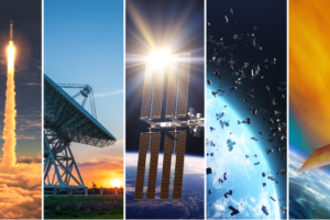
There are almost 5,500 active satellites in orbit as of spring 2022, and one estimate predicts the launch of an additional 58,000 by 2030. Large constellations of satellites in low Earth orbit are the primary drivers of the increase. Satellites provide important services, but there are potential environmental and other effects that this trend could produce (see figure).

Potential effects from the launch, operation, and disposal of satellites

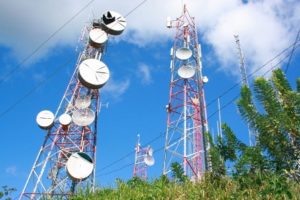
For decades, satellites have been used for GPS, communications, and remote sensing. The number of satellites has recently increased, as thousands more have been launched to provide internet access.

But this increase may be disruptive. For example, it could lead to more space debris, which can damage existing satellites used for commerce or national security. We reviewed technologies and other tools to lessen potential effects. We also looked at mitigation challenges, like unclear rules and immature technology. To help address the challenges, we developed policy options, which may help policymakers achieve a variety of goals.

GAO assessed technologies and approaches to evaluate and mitigate the following potential effects:

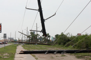
- Increase in orbital debris. Debris in space can damage or destroy satellites, affecting commercial services, scientific observation, and national security. Better characterizing debris, increasing adherence to operational guidelines, and removing debris are among the possible mitigations, but achieving these is challenging.
- Emissions into the upper atmosphere. Rocket launches and satellite reentries produce particles and gases that can affect atmospheric temperatures and deplete the ozone layer. Limiting use of rocket engines that produce certain harmful emissions could mitigate the effects. However, the size and significance of these effects are poorly understood due to a lack of observational data, and it is not yet clear if mitigation is warranted.
- Disruption of astronomy. Satellites can reflect sunlight and transmit radio signals that obstruct observations of natural phenomena. Satellite operators and astronomers are beginning to explore ways of mitigating these effects with technologies to darken satellites, and with tools to help astronomers avoid or filter out light reflections or radio transmissions. However, the efficacy of these techniques remains in question, and astronomers need more data about the satellites to improve mitigations.

GAO developed the following policy options to help address challenges with evaluating and mitigating the effects of large constellations of satellites. GAO developed the options by reviewing literature and documents, conducting interviews, and convening a 2-day meeting with 15 experts from government, industry, and academia. These policy options are not recommendations. GAO presents them to help policymakers consider and choose options appropriate to the goals they hope to achieve. Policymakers may include legislative bodies, government agencies, standards-setting organizations, industry, and other groups.

Policymakers may be better positioned to take action on this complex issue if they consider interrelationships among these policy options. For example, implementing the fourth option (improving organization and leadership) may improve policymakers’ ability to implement the first and second options (building knowledge, developing technologies, and improving data sharing). Similarly, implementing the first option may help with the third option (establishing standards, regulations, and agreements). More generally, trade-offs between mitigations may emerge, the ongoing increase in new constellations may introduce unexpected changes, and a large and diverse set of interests from the global community may shift over time, all of which present persistent uncertainties. To address these complexities and uncertainties, the full report presents the policy options in a framework, which may help policymakers strategically choose options to both realize the benefits and mitigate the potential effects of large constellations of satellites.

Enabled by declines in the costs of satellites and rocket launches, commercial enterprises are deploying large constellations of satellites into low Earth orbit. Satellites provide important data and services, such as communications, internet access, Earth observation, and technologies like GPS that provide positioning, navigation, and timing. However, the launch, operation, and disposal of an increasing number of satellites could cause or increase several potential effects.

This report discusses (1) the potential environmental or other effects of large constellations of satellites; (2) the current or emerging technologies and approaches to evaluate or mitigate these effects, along with challenges to developing or implementing these technologies and approaches; and (3) policy options that might help address these challenges.

To conduct this technology assessment, GAO reviewed technical studies, agency documents, and other key reports; interviewed government officials, industry representatives, and researchers; and convened a 2-day meeting of 15 experts from government, industry, academia, and a federally funded research and development center. GAO is identifying policy options in this report.

Effective communication of disaster warnings saving lives in Fiji

Communication is key – especially when you are in the business of saving lives.

During their Ignite session on the second day of the Asia-Pacific Ministerial Conference on Disaster Risk Reduction in Brisbane, Australia, the FMS presented on disaster risk communication and effective information sharing, in order to give people a better understanding of the importance of effective communication of warnings and understanding user needs.

FMS Medial Liaison Manager, Ms Ana Sovaraki, said the Fiji Meteorological Service, as well as being a Regional Meteorological Centres in the world, has always tried to ensure the effective and timely dissemination of warnings before and during disasters.

“Following the events of Severe Tropical Cyclone Winston in 2018, the Met Service realised, amongst other things, the need to improve and enhance communication and dissemination systems” she said.

It was then that the FMS decided to create a communications role within the department to develop communications strategies to ensure warning messages are reaching the users on time. They were the first Met Service in the region to do so.

The FMS has since worked on genuinely integrating communications into their forecasts and ensuring users of information understand the warnings which in turn helps communities prepare for natural disasters in Fiji.

One of the ways in which they have done this is through impact-based early warnings communicated effectively to prompt actions. The warning bulletins now include potential or expected impacts which they have found to be more relatable to people than just forecast warnings.

“For example, if there is a tropical cyclone and the forecast says to anticipate 50km/h winds, this information alone may not be understood by a layman,” Ms Sovaraki said.

“However, if we integrate the anticipated or possible impact by saying that this wind strength is capable of ripping off roofs and uprooting trees, it can be more relatable to people and they can then take action based on that information. Impact-based communications ensures that the information is understandable, relatable, and reaches the last mile.

Another key aspect of effectively communicating forecasts and warnings is to understand the needs of users and developing user-specific products and information to meet those needs.

“We can have the best warning and forecasts, and our Communications people can give us the best key messages but if does not meet the needs of the users, then those warnings and messages do not serve a purpose,” said Director of the Fiji Met Services, Mr Terry Atalifo.

“The Met Service is moving towards trying to understand the needs of people, how vulnerable they are to disasters, and the risks these people face during disasters. This will place us in a better position to ensure that the service they provide meets these needs and requirements.”

The FMS does this by continuing to engage with stakeholders, which is a key component of their work.

“We have meetings and national forums every year to make sure that we understand the needs of these stakeholders.”

Mr Atalifo thanked all their Pacific partners and those in Australia and New Zealand who provide the support to FMS to ensure that they are able to better understand the needs of people.

Building resilience in Palau through early warning systems

The residents of Palau have benefitted from effective and low-cost, low-tech early warning systems, installed through the World Meteorological Organisation (WMO) Climate Risk and Early Warning Systems (CREWS) Pilot Project.

Palau initially received sirens which were installed as part of their early warning systems. However, the residents soon realised that these technologies also came with a myriad of challenges, including the sirens breaking down, difficulties in finding back ups or replacement parts, and the cost of maintenance.

These challenges were especially hard on the outlying islands, which did not have regular access to the necessary tools and resources needed to support and maintain the warning sirens.

The CREWS Pacific SIDS Pilot Project introduced the use of low-cost, low-tech early warning systems as a solution. These consisted mainly of bells that were strategically placed around the three initial areas of Ngaraard, Ngiwal and Kayangel.

The Palau National Weather Service took the lead in the implementation of the pilot project, in partnership with the National Emergency Management Office and the Palau Red Cross Society, which was already well established in the community through their Red Cross Disaster Action teams scattered throughout all 16 states of Palau.

Executive Director of the Palau Red Cross Society, Ms Maireng Sengebau, said they had to work with the community and build their capacity to understand what early warning systems are.

“We had to get them to accept these systems and show their support by providing us with a piece of land on which the bells would be installed,” she said.

Once the bells were installed, the Palau Meteorological Service, working in partnership with the Palau Red Cross Society, would meet with various communities and conduct table-top exercises and drills to familiarise them with the early warning systems and to demonstrate how and when they should be used.

"These activities empowered the people in communities. As a result of these meetings, they are now aware of what early warning systems are and why they are important, and also what to do when there is a disaster coming. They have now taken ownership the system and are the ones who operate it and they report to the state government if it needs maintenance.”

These simple early warning systems have contributed greatly to the resilience of the people of Palau.

“I joined the Palau Red Cross in 2017, and growing up, if there was a typhoon we would just buckle down in our houses and pray. Once the typhoon passes, we would wake up the next morning and just wait for government officials to come and bring help,” said Ms Sengebau.

“That is no longer the case. Now, before the typhoon even hits, families know when and how to act. If your house is not strong enough, they need to move to the evacuation shelter. If your house is strong, make sure that your family has a disaster kit.

“There are now things they can do to minimise the damage. Instead of waiting, we can now take action even before a disaster occurs. This is made possible through these early warning systems, and how they have empowered people in communities to act during natural disasters.”

Experts Assess Implementation of International Conventions on Nuclear Emergency Response


Countries need to work closely together in the event of a nuclear emergency, so sharing experience and improving emergency preparedness are key tasks stemming from the IAEA’s mandate. Those responsible for emergency preparedness at the national level – officially referred to as Competent Authorities – met in Vienna last week at the 11th Meeting of the Representatives of Competent Authorities identified under the Early Notification Convention and the Assistance Convention, and discussed ways to ensure that the necessary expertise, services and equipment are available promptly upon request by any government in the event of a nuclear or radiological emergency.

In his remarks, IAEA Director General Rafael Mariano Grossi referred to the role of the two conventions in relation to nuclear facilities in Ukraine. “Everything we have done to assist Ukraine in maintaining nuclear safety, security and an adequate level of safeguards; everything we have done to inform the wider world of the situation during this first military conflict fought in the direct proximity of a major nuclear power programme, we have done through the framework that many of you have built and improved in the years leading up to today…this framework is being tested like never before,” he said.

A strong and integrated international framework for notification and assistance in the event of a nuclear emergency is essential to protect people and the environment from the harmful effects of ionizing radiation, said the meeting’s Chair, Faizan Mansoor, Head of the Pakistan Nuclear Regulatory Authority. “This meeting is essential, since it gathers the world’s experts in nuclear emergency preparedness and response to determine if our arrangements remain effective when emergencies occur under increasingly complex conditions,” he said.

Competent Authorities are the entities designated by their governments to carry out specific duties with respect to issuing and receiving information relating to nuclear and radiological emergencies under these conventions. They meet every two years to evaluate and strengthen the implementation of the Early Notification Convention and the Assistance Convention. Both conventions were concluded in 1986, in the immediate aftermath of the accident at the Chornobyl Nuclear Power Plant, and establish the international framework for the exchange of information and the prompt provision of assistance in the event of a nuclear or radiological emergency, with the aim of minimising the consequences.

“Radiation does not recognize borders, and countries need to work together swiftly to prevent people from coming to harm in the wake of a transboundary radioactive release,” said Carlos Torres Vidal, Director of the IAEA’s Incident and Emergency Centre.
Preparing to Respond to a Rare Event

The IAEA has created a number of platforms and mechanisms, such as the Unified System for Information Exchange in Incidents and Emergencies (USIE), the International Radiation Monitoring Information System (IRMIS) and the Assessment and Prognosis Tools and the Response and Assistance Network to help countries work with each other, and with the IAEA and other international organizations, during a response. For example, USIE is a secure platform for information sharing that allows countries to fulfil their obligations under the Early Notification Convention; the same function is performed for the Assistance Convention by the Response and Assistance Network, or RANET, which allows countries to offer, and receive, assistance and expertise; and IRMIS collects and maps large quantities of environmental radiation monitoring data during nuclear or radiological emergencies.

The IAEA supports countries in setting up robust preparedness mechanisms, through the development of safety guides and publications, and the provision of trainings and other capacity-building initiatives.

Although most people associate nuclear emergencies with accidents at nuclear power plants, such as those at Chornobyl (1986) and Fukushima Daiichi (2011), such events are in fact very rare. At the same time, the Response and Assistance Network has been mobilized several times in the past decade to respond to countries dealing with the consequences of far more common radiological emergencies, such as workers becoming accidentally exposed to hazardous levels of radiation from contact with radiation sources used in industry or medicine.

“These past two years have demonstrated that emergencies come in diverse forms such as earthquakes, floods and fires, and that we need to pay more attention than ever before to our motto: Prepare. Respond. Improve,” said Lydie Evrard, Deputy Director General and Head of the Department of Nuclear Safety and Security.