Joint Research Centre launches a revolutionary tool for monitoring ongoing floods worldwide as part of the Copernicus Emergency Management Service
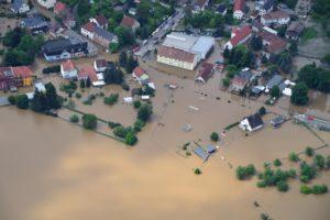
The European Commission’s Joint Research Centre (JRC) unveiled the beta version of the Global Flood Monitoring (GFM) tool, unique for its capacity to process all data received by the Copernicus Sentinel-1 satellites.

Making use of the synthetic aperture radar of Sentinel-1 that enables image acquisitions regardless of weather or daylight conditions, this tool will improve both the emergency response and the prevention for future floods worldwide.

It produces flood monitoring maps within less than 8 hours after the satellite has acquired the image at a spatial resolution of 20m at global level.

For Europe, the tool can provide updated flood monitoring maps every 1-3 days whereas for areas outside Europe updating of the flood maps may take between 6-12 days depending on the Sentinel-1 schedule.

The tool is currently accessible through the map viewer of the Global Flood Awareness System (GloFAS) of the Copernicus Emergency Management Service (CEMS) and will be, at a later stage, also available through the map viewer of the European Flood Awareness System (EFAS).

The monitoring of the ongoing floods using satellite data from GFM, complements the flood forecasts of EFAS and GloFAS that are calculated using weather predictions and a hydrological model.

The combination of both tools within one interface enables its users to better support the preparedness of an upcoming flood (forecasts) as well as the response to an ongoing flood event (monitoring). This constant, global, high-resolution monitoring represents a significant progress in the EU’s disaster awareness and prevention.

The results produced by GFM can be used for planning and coordinating emergency response to an ongoing flood or for supporting the international help in affected areas. In addition, the archive of the GFM, which contains flood monitoring maps derived from the processing of all Sentinel-1 data starting 1.

January 2015, enables decision makers to improve prevention plans to avoid or to reduce the impact of future floods and scientists to use the dataset of GFM to validate or calibrate models for improving predictions of impacts of floods under climate change.

The GFM is the result of years of scientific development of the JRC and partners (Earth Observation Data Center, Technical University of Vienna, Luxembourg Institute of Science and Technology, Deutsches Zentrum fuer Luft und Raumfahrt, Geoville, CIMA Research Foundation). This latest addition to the CEMS portfolio of products is launched during the CEMS Days, an event bringing together users of the CEMS tools to discuss the service and its evolution.

During the CEMS days, the JRC also presented the Global Human Settlement Layer (GHSL), which produces global spatial information about the human presence on the planet over time. GHSL has now been added to the CEMS suite of tools, as a new ‘exposure mapping’ component. Detailed information on exposure is fundamental to adequately managing crisis and disaster risk.

The GHSL provides highly accurate information derived from satellite and census data. It can help in answering questions like: how many people are living in the flooded areas? Or: how many settlements and people will be affected by a cyclone?

This information will be used in the on-demand mapping and early warning and monitoring components of CEMS. The information is also useful for a wide range of domains, from monitoring urbanisation to the progress towards the Sustainable Development Goals.

How science can help build a more resilient Europe

Enhanced data collection, more knowledge sharing and a long-term approach to risk will be key in strengthening Europe’s resilience against future disasters, according to a new book published today by the JRC.
Drawing lessons from the coronavirus pandemic and other crises, ‘Science for Disaster Risk Management 2020: acting today, protecting tomorrow’ explores how to protect lives, livelihoods, the environment and our rich cultural heritage from future disasters.
With input from over 300 experts, the book highlights the important role of science in preparing Europe to face the challenges that lie over the horizon.
Commissioner for Crisis Management, Janez Lenarčič, said: “As disasters defy borders the EU supports national action and promotes cross-border cooperation on disaster risk management – with the EU Civil Protection Mechanism being at the heart of this work. Using all data, science and lessons learnt available is vital to strengthen the collective safety and resilience against disasters in the EU and beyond”.
Commissioner for Innovation, Research, Culture, Education and Youth, Mariya Gabriel said: “The Joint Research Centre has long held key expertise in disaster risk management, spawning valuable tools like early warning systems and satellite mapping services, disaster risk studies and global risk models. The new book ‘Science for Disaster Risk Management 2020: acting today, protecting tomorrow’, is the latest of these tools: it shows how vital science is in helping us prepare for disasters, and how we can all work together to learn the lessons of the past and prepare better for the future.”
The aftermath of disasters can be learning opportunities, both in recovering quickly and dealing with the underlying drivers of disaster risk to avoid or mitigate similar events. This new book provides several examples and recommendations on how to grasp these opportunities to build a more resilient future.
Data is key to understanding the impact of disasters, and better managing them in the future
Events like the Fukushima accident in 2011 or the coronavirus pandemic show that, however improbable they may seem, disasters do occur and they can have a huge impact.
On a practical level, past disasters can serve to highlight weaknesses and trigger changes in the policy framework. For example, the forest fires of 2017 in Portugal caused a reassessment of fire management policies and led to new legislation to protect people and territory from forest fires.
To make the most of these opportunities, scientists need quality, comprehensive data and information gathered after a disaster to develop the right methodologies and tools. The book authors recommend developing a mechanism so that disaster loss data can be collected and used in this way.
A major challenge to collating and using data is that much of the damages and loss to cultural and environmental ecosystems caused by disasters can remain hidden when the value of these assets are not easy to define in economic terms.
It is hard to put a price on cultural artefacts or quantify what is lost when certain oral traditions and customs are no longer performed.
As a first step, the authors recommend compiling an inventory of the current state of cultural heritage assets in Europe, which can contribute to preserving that heritage in the face of disasters.
Taking a long-term view on disaster risk
The book also calls for a shift from a short-term, reactionary approach to disaster risk management, towards a long-term view that tackles the underlying drivers of risk - such as inequality, urbanisation, or climate change.
For example, the authors show how urban planning can play a key role in avoiding building in risk-prone areas like flood plains. Climate change also poses a challenge that requires a long-term response: sectors like European agriculture will need to deal with more frequent and extreme weather events in the coming years.
The book recommends actions such as supporting research groups from across different scientific disciplines to work together to find nature-based innovative solutions to societal challenges.
Sharing knowledge and working together to become more resilient
In today’s complex world and the many links between assets, sectors and governance levels, disasters often have an impact across countries and sections of society. It is therefore necessary that different stakeholders and groups share their data and knowledge to co-create effective strategies to reduce disaster risk.
One positive example of this came following the explosion of a fertiliser plant near Toulouse in 2001. It triggered a set of actions to engage local stakeholders in the co-design of strategies and measures to deal with technological risk.
By establishing local committees for information and consultation, people can now participate in the decision-making process and implementation of measures to prevent these risks, while also having an influence on land-use planning.
The book recommends education and training to raise awareness and build the capacity of individuals and communities to contribute to these efforts.

New EU tool to support the assessment of wildfire risks and the mitigation of effects in Latin America and Caribbean region

The Joint Research Centre has developed country profiles under the Global Wildfire Information System (GWIS) helping to support wildfire management and disaster risk reduction globally but in particular, in the Latin American and Caribbean (LAC) region.
These profiles provide information on the geographic distribution of wildfires, burnt areas and emissions, and assess wildfire regimes and impacts at country and sub-country level for all continents worldwide.
Commissioner for Innovation, Research, Culture, Education and Youth, Mariya Gabriel, said: "Wildfires can have catastrophic consequences on the environment and on people. The country profiles designed by the Joint Research Centre will contribute to the risk assessment and mitigation of this danger, proving how science can help improve and protect lives and our planet."
Mette Wilkie, Director of the Forestry Division, FAO said:
"The opportunity for countries around the world to assess their national fire situation through the Wildfire Country Profiles of GWIS is fundamental to understanding fire risk and underpinning plans to mitigate the effects of wildfires. These efforts are critical to the achievement of Sustainable Development Goals related to climate change mitigation, biodiversity conservation and sustainable livelihoods. FAO looks forward to continuing collaboration with the EC through JRC and GWIS, particularly in Latin America and the Caribbean."
Leo Heileman, UN Environment Programme's Regional Director for Latin America and the Caribbean said:
"UNEP is delighted to support, along with FAO, a new information system that will improve wildfire management and strengthen disaster risk reduction in Latin America and the Caribbean, including the Amazon region. This kind of initiatives are part of an upgraded framework of cooperation agreed in February 2021 between the European Commission and UNEP aimed to step up efforts to tackle the climate, biodiversity and pollution crises, thus supporting countries build a healthier and more inclusive and resilient future for all."
Steven Ramage, Head of External Relations at the GEO Secretariat said:
"The Group on Earth Observations (GEO) welcomes the development of the GWIS country profiles by the European Commission’s Joint Research Center (JRC). This application is a unique resource to enhance wildfire prevention, preparedness and effectiveness in wildfire management. It provides access to critical wildfire information for governments and practitioners alike to prepare and respond to natural hazards.
GWIS is one of the most successful collaborative initiatives within the GEO Work Programme, providing Earth observations data and tools to enable informed national responses in the context of the Sendai Framework for Disaster Risk Reduction and the Paris Agreement on climate change."
This information is essential to allow a global assessment of wildfire risk and to mitigate the effects of wildfires on land degradation, deforestation, or biomass burning emissions.
They contribute to shaping appropriate policies, reducing community exposure, mitigating damage and increasing resilience to wildfire events. These GWIS services also contribute to the implementation of Sustainable Development Goals (SDGs), reducing the impact of climate change and disaster risk.
These country profiles are part of the new European Commission initiative to support wildfire management and disaster risk reduction globally and in particular in Latin America and the Caribbean.
This JRC action will fit into a comprehensive approach by the EU to support conservation and sustainable development of the Amazon forests.
There are at present more than 50 EU programmes on this regional priority, and the new budget for global Europe will also cover a specific Amazon strategy, coordinated with EU Member States.
This will be implemented in collaboration with the EU Delegations in the LAC region, supporting forthcoming EU programs in the region under the EU Green Deal strategy.
Through a Team Europe Initiative for the Amazon basin, coordinated actions in the field of forest conservation, sustainable agriculture, and environmental governance, will strengthen the impact and use of the GWIS services.

JRC proposes a new framework to raise awareness and resilience against hybrid threats

A new conceptual framework on hybrid threats designed by researchers aims to increase the understanding of hybrid threats and facilitate the development of effective measures to improve resilience against these threats.
The 'hybrid threats' concept refers to coordinated action conducted by hostile state or non-state actors with the deliberate goal to undermine or harm democratic states.
Although the topic is high on the political agenda, our understanding of hybrid threats is often limited to past experiences and known forms of interference, such as disinformation and terrorism.
Working together with the Centre of Excellence for Countering Hybrid Threats (Hybrid CoE), the JRC has developed a conceptual framework, which describes the components of hybrid threats in terms of actors, their objectives, tools, the domains that can be compromised as well as the different phases of action.
Speaking during the launch event of the conceptual framework, Mariya Gabriel, European Commissioner for Innovation, Research, Culture, Education and Youth, said: "The EU has the capacities and know-how to build its resilience against hybrid threats. But we need to understand the problem in depth to be able to design an effective response. It is our advantage that we ground our policy actions on science. The conceptual framework is an instrumental part of this process. It provides a comprehensive description of hybrid threats, actors and the tools that can be used against EU countries."
The work aims to facilitate the early detection of hybrid threats, the identification of gaps in preparedness and response and the development of effective measures to counter this complex phenomenon.
The research teams call for a whole-of-society approach, which brings together all civil, military and political actors for a more effective response to hybrid threats.
Understanding modern hybrid threats
The concept of hybrid threats is not new, but modern tools and technologies, as well as increased levels of connectivity have enabled the actors behind hybrid threats to organise attacks with potentially devastating effects.
Cyberattacks, disinformation campaigns and election interference can be part of hybrid threat activity, but none of them constitutes a hybrid threat alone.
Hybrid campaigns can be a combination of both conventional and non-conventional means, including classic warfare, cyberattacks, fake news and election interference.
They are designed to be difficult to detect or attribute to any individual or group.
The actors behind these actions aim to create ambiguity and confusion by blurring the borders of what is true and what is false, what is acceptable and what is unacceptable behaviour, manipulating legal thresholds and making it difficult attribute responsibility for wrong-doing to any particular actor.
The overarching objective of the actors is to undermine public trust in democratic institutions, challenge the core values of societies, gain geopolitical influence and weaken the decision-making capacity of countries.